GPS Satellite Map, Live Camera
GPS Satellite Map, Live Camera
GPS route satellite maps live traffic camera views
Screenshots


GPS Satellite Map, Live Camera: Real-Time Navigation and Live Viewing
GPS Satellite Map, Live Camera is a mobile application that combines high-definition satellite imagery, real-time GPS navigation, and live street-level camera feeds into a single, user-friendly platform. It allows users to explore locations worldwide through detailed maps, track their current position with precision, and view live camera streams from public sources to assess traffic, weather, or surroundings. The app integrates global positioning system technology with satellite mapping to provide accurate route planning and location insights, making it a versatile tool for travelers, commuters, and outdoor enthusiasts. Its core appeal lies in merging traditional navigation with live visual data, enhancing situational awareness beyond standard map applications.
Chapter 1: Function
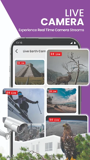
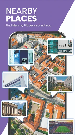
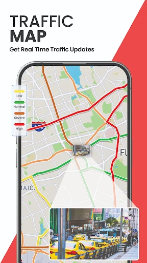
The application offers three primary functions: GPS navigation, satellite map viewing, and live camera access. The GPS navigation feature provides turn-by-turn directions with real-time location tracking, alternative route suggestions, and estimated arrival times based on current traffic conditions. Users can search for addresses, points of interest, or coordinates to generate optimized routes for driving, walking, or cycling. The satellite map function displays high-resolution aerial imagery from global satellite databases, allowing users to zoom in on specific areas for detailed topographic or urban views. This includes terrain layers, 3D building models, and geographic labels. The live camera feature integrates publicly available webcams and traffic cameras, enabling users to view real-time streams of streets, intersections, landmarks, or natural sites. This function aids in assessing road conditions, weather, foot traffic, or scenic views before traveling. Together, these tools provide a comprehensive spatial awareness solution.
Chapter 2: Value
The app delivers significant value by addressing common limitations of standard map applications, such as outdated imagery or lack of live visual context. Its key advantage is the seamless integration of real-time camera feeds with satellite navigation, which empowers users to make informed decisions based on current visual data. For example, a driver can check a live camera feed of a destination or route segment to verify congestion, road closures, or parking availability before departing, saving time and reducing uncertainty. The high-resolution satellite imagery supports detailed geographical analysis for planning outdoor activities like hiking, skiing, or photography, offering views of terrain, vegetation, and water bodies that generic maps lack. The app also benefits users in remote or unfamiliar locations by providing offline map caching and location tracking even without internet connectivity. Privacy is addressed through anonymized user data processing and reliance on publicly accessible camera feeds, minimizing ethical concerns. Additionally, the app updates its map data and camera lists regularly, ensuring reliability. The combination of precision GPS, visual verification, and global coverage makes it a strong alternative to conventional navigation tools, particularly for those who prioritize safety, efficiency, and accessibility. The interface is designed for intuitive use, with search filters, voice commands, and customizable map layers that adapt to different user preferences.
Chapter 3: Scenarios
The primary target user groups include daily commuters, long-distance travelers, outdoor adventurers, and logistics professionals. Commuters use the app to check live traffic cameras along their regular routes, avoiding bottlenecks and choosing faster alternatives during rush hours. Travelers rely on satellite maps to preview remote destinations, identify landmarks, and navigate unfamiliar cities without relying solely on street-level signs. Outdoor enthusiasts, such as hikers, cyclists, or geocachers, utilize satellite imagery to study trail topography, water sources, or vegetation cover before expeditions, while live cameras help monitor weather conditions at trailheads. Logistics and delivery drivers leverage the app for real-time route optimization and visual confirmation of delivery points, reducing missed stops and improving time management. Emergency responders, including paramedics or disaster relief teams, can access satellite views and live cameras to assess disaster zones, road accessibility, or crowded areas, facilitating faster response planning. Additionally, real estate professionals and travelers use satellite maps to evaluate neighborhoods or property surroundings remotely. The app supports these diverse scenarios through robust location searching, multi-layer map overlays, and reliable camera indexing, ensuring utility across varied use cases from daily errands to critical operations.
Advantages
- shows real-time street-level camera feeds on map
- overlays GPS coordinates with live satellite imagery
- offline map caching for remote navigation
- low battery consumption during continuous tracking
- supports multiple overlays like traffic and terrain
Disadvantages
- camera feeds often delay by 30 seconds or more
- requires stable internet for live view functionality
- map data updates infrequently in rural regions
- no voice-guided turn-by-turn navigation
- privacy concerns over shared location history
Frequently Asked Questions
Q: What is the core function of this app?
A: The app combines GPS satellite navigation with live camera overlays, allowing users to view real-time traffic conditions, street-level imagery, and satellite maps simultaneously. It provides turn-by-turn directions with augmented reality guidance, showing arrows and route info directly on the phone camera feed for safer, hands-free driving or walking.
Q: Is the app free to download and use?
A: The app is free to download with basic GPS navigation and satellite map viewing. Advanced features like live camera streaming, offline map downloads, and ad-free use require a subscription, available as weekly, monthly, or yearly in-app purchases. No additional hardware is needed beyond your device’s camera and GPS.
Q: Does the app require an internet connection to work?
A: Yes, live camera streaming and real-time traffic updates require an active internet connection (Wi-Fi or mobile data). However, downloaded offline maps for specific regions can be accessed without internet for basic navigation, but live camera overlays and live traffic data will not function offline.
Q: Can the live camera feature drain my phone battery?
A: Yes, using the live camera overlay continuously will drain the battery faster than standard GPS apps, as it keeps the camera active and processes video data. For longer trips, it is recommended to have a car charger or power bank ready. Lowering screen brightness and closing background apps can help extend usage time.
Q: How accurate is the satellite imagery and traffic data?
A: Satellite imagery is sourced from global mapping providers and updated periodically, not in real time. Traffic data is live, aggregated from user reports and local sensors, with normal accuracy for major roads. In remote or poorly mapped areas, satellite image age and traffic predictions may be less reliable.
Technical Information
Recommended for You

Caesars Rewards Resort Offers

MMGuardian Parental Control

Good Lock

Dabble - DFS & Player Props

Vocal Image: AI Voice Coach

AR Art Projector: Da Vinci Eye

Mods&Skins for Melon

Snapseed

GPS Speedometer : Odometer HUD

Indeed Job Search

Ovia Pregnancy & Baby Tracker

Pink Cute Hippo Theme

Messages: Text Message, SMS

OKN Drum Pro

Centi PRO - Currency Converter

Face Massage, Skincare: forYou

Ringtones Music for Phone

DramaBox - Stream Drama Shorts

Lift: Reels & Stories Maker

Cut and Paste Photo Editor

Waze Navigation & Live Traffic

Paramedic Protocol Provider

PXPlay: Remote Play
