OCEARCH Shark Tracker™

OCEARCH Shark Tracker™
OCEARCH Shark Tracker connects you to shark migration science
Screenshots
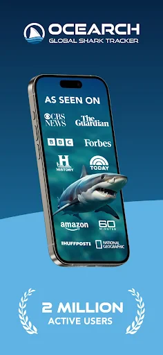
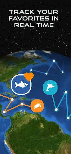
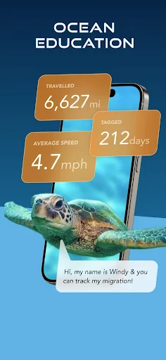

OCEARCH Shark Tracker: Real-Time Ocean Exploration and Conservation Tool
OCEARCH Shark Tracker is a mobile application that enables users to follow the movements of tagged sharks, sea turtles, and other marine species in real time. Developed by the nonprofit OCEARCH organization, the app provides an interactive map displaying migration patterns and behavioral data collected through scientific expeditions. It serves as both an educational resource and a citizen science platform, allowing users to engage directly with marine biology research.
Chapter 1: Function
The core function of OCEARCH Shark Tracker is to visualize the real-time location and historical tracks of tagged marine animals. Users can access an interactive global map that updates with satellite or acoustic tag data, showing individual animal profiles including species, size, sex, and tagging history. The app also features expedition logs, research articles, and multimedia content such as videos and photos from field missions. Notifications alert users when a tracked animal approaches their area, fostering local awareness. Additionally, the platform includes educational materials on shark behavior, migration triggers, and ecosystem health, making complex scientific data accessible to non-experts.
Chapter 2: Value
OCEARCH Shark Tracker provides significant value by bridging the gap between scientific research and public engagement. Its primary advantage is transparency: it offers unmediated access to real-time data from ongoing conservation projects, allowing users to observe how top predators move across oceans in response to environmental changes. This fosters a deeper understanding of marine ecosystems and counters common misconceptions about shark behavior, reducing fear and promoting coexistence. For educators, the app serves as a dynamic teaching tool that integrates STEM concepts like biology, geography, and data analysis into classroom activities. Conservationists benefit from the app’s ability to crowdsource observations and generate public support for policy changes, such as shark fishing bans or marine protected area designations. Researchers can use the aggregated data to identify critical habitats and migration corridors, informing more effective conservation strategies. The app’s emphasis on storytelling—through expedition narratives and individual animal biographies—humanizes scientific research, making it emotionally resonant and motivating users to participate in citizen science initiatives like reporting sightings or donating to expeditions. By democratizing access to scientific data, OCEARCH Shark Tracker empowers individuals to become active stakeholders in ocean conservation, turning passive awareness into measurable impact.
Chapter 3: Scenarios
The primary target users of OCEARCH Shark Tracker include educators, students, marine biology enthusiasts, and coastal residents. In educational settings, teachers integrate the app into biology or environmental science curricula, using real-time tracks to illustrate migration patterns, food web dynamics, and human-wildlife conflict. Students complete assignments analyzing track data, predicting future movements based on seasonality, or comparing behaviors across species. Coastal residents, such as surfers, fishermen, and beachgoers, use the app to check recent shark activity near popular swimming or surfing spots, enhancing personal safety awareness and reducing fear through evidence-based understanding. Conservation volunteers rely on the app to identify when tagged animals enter their local waters, organizing community events like beach cleanups or reporting suspicious fishing activity. Media professionals and documentary filmmakers use the platform to find compelling visual narratives for ocean-related stories. Finally, amateur scientists contribute to research by logging weather conditions or water temperature at the time of sightings, supplementing the app’s data with ground-level observations. Everyday scenarios include checking the app before planning a kayaking trip, following a tagged great white shark’s thousand-mile journey as a family activity, or referencing track data during a school science fair project.
Advantages
- real-time satellite tracking of tagged sharks globally
- displays migration routes with historical playback
- species filter narrows to specific shark types
- data feeds directly from OCEARCH research expeditions
- minimal battery drain despite continuous GPS polling
Disadvantages
- limited to sharks tagged by OCEARCH only
- no push notifications when a shark nears your area
- map lags during rapid zoom or pan on older devices
- offline mode saves only last viewed track
- not full history
- requires internet connection for live position updates
Frequently Asked Questions
Q: What does OCEARCH Shark Tracker app do?
A: The app tracks real-time locations of tagged sharks and marine animals via an interactive global map. It provides species data, migration patterns, and expedition logs. No additional equipment is needed beyond your device's GPS and internet connection. It is free to download with no in-app purchases required.
Q: Is the app free to use with all features unlocked?
A: Yes, the app is entirely free with no in-app purchases or subscriptions. All tracking data, species profiles, and educational content are accessible without payment. There are no hidden fees or locked premium features. The only requirements are an internet connection for map updates and location permissions for local tracking.
Q: Does the app work on both iPhone and Android devices?
A: The app is available on iOS (iPhone/iPad) and Android devices. It requires iOS 12.0 or later and Android 6.0 or higher. The app is optimized for smartphone screens but functions on tablets with scaled interface. No Bluetooth or external hardware is needed. Offline map access is not supported.
Q: How accurate is the shark tracking data?
A: Tracking positions update when a tagged animal's transmitter pings a satellite or receiver, typically within 500 meters accuracy. Ping frequency varies from daily to weekly depending on surfacing behavior and satellite coverage. The app displays only verified pings and historical tracks. Real-time location is not guaranteed for deeply submerged animals.
Q: Can I report a sighting or submit my own tagging data?
A: No, the app does not accept user-submitted sightings or tagging data. All tracking information comes exclusively from OCEARCH's scientific expeditions and partner research institutions. The app currently has no community reporting feature or crowdsourced data input. For feedback or data requests, users are directed to the official OCEARCH website contact form.
Technical Information
Recommended for You

Carvana: Buy/Sell Used Cars

Google Assistant

FloatMe: Budget & Cash Advance

US News: Breaking News & Local

WCYB StormTrack 5

PeakFinder

BimmerCode for BMW and MINI

Video Downloader: HD Player

Impact Ballistics

HOMER: Fun Learning For Kids

Recipe Keeper
Voices: Change Your Voice

Sky Tonight - Star Gazer Guide

Glassdoor | Jobs & Community

ExtraMile Rewards®

Fishbrain - Fishing App

Sketchbook Lite - Artbook
Google Calendar

Today's Hit Music Ringtones

Filmora:AI Video Editor, Maker
3D Anatomy
Apps 4 Chromecast & Android TV
Onn Smart TV Remote